
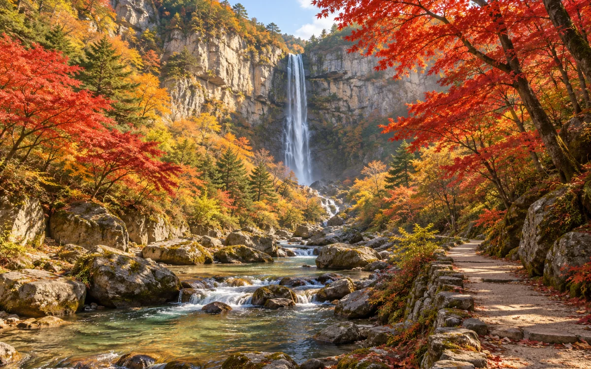
At a glance
- The basic order is park entrance → Byeongpung Falls → Gangcheonsa → suspension bridge junction → Gujanggun Falls → return the same way. This is an out-and-back walk to the start, not a loop.
- At the Sunchang County Health and Medical Center stop to the right of Sunchang Bus Terminal's entrance, check which buses toward Jeongeup, Bokheung, Ssangchi, or Gurim via Gangcheonsa stop at Gangcheonsan before boarding. The official guide gives a 900 m walk of about 15 minutes from Gangcheonsan bus stop to the park. Peak-season traffic may prevent buses entering the park, so a reserved vehicle is more reliable.
- Choose wild greens bibimbap, rice mixed with greens, near the park entrance, or traditional sundae or a warm soft-tofu set meal in downtown Sunchang. Keep travel between these dining areas in mind.
- The first day visits to Gochujang Folk Village or Fermentation Theme Park require separate vehicle travel. Do not add Hyangga Recreation Area and Janggunmok all at once.
Separate the basic valley walk from the optional bridge
A conceptual diagram of the start, waterfalls, temple, and turnaround. The bridge stairs are an option separate from the basic valley route.
See the travel guidance for each stop below.
-
Gangcheonsan park entrance Start and return
Check on-site route figures and restrictions.
Open in Google Maps: Gangcheonsan park entrance DirectionsDepart Sunchang Bus Terminal Gangcheonsan park entrance
-
Byeongpung Falls Waterfall
A waterfall near the beginning of the valley path.
-
Gangcheonsa Mountain temple
A possible turnaround when tired or conditions are wet.
-
Suspension bridge junction Optional
Climb only when the stairs and bridge are in good condition.
-
Gujanggun Falls Turnaround
After seeing the falls, return along the same valley path.
-
Dining area at the Gangcheonsan entrance Meal
Choose a wild greens meal here or travel into Sunchang.
Open in Google Maps: Dining area at the Gangcheonsan entrance DirectionsDepart the park entrance Dining area at the Gangcheonsan entrance
Before choosing a route
Distinguish the current 5.5 km Barefoot Walking Trail from the 7 km Gangcheonsan Trail including the bridge. Do not use the poorly sourced 5 km as the basic figure.
An optional stair section with a different difficulty from the valley path.
Day by day
2 days and 1 night in Sunchang
The times below are an editorial itinerary example with room for rest and the return trip. They do not guarantee actual train or bus departure times or journey lengths. Finalize your plan against booking screens and with your driver.
On the first day, travel from Seoul to Sunchang and stay overnight, visiting only Sunchang Fermentation Theme Park after checking its hours. Reserve a vehicle for the next day to drop you off and pick you up at a permitted park access point.
Second-day example: leave the ticket office at 09:00, walk the currently listed Barefoot Walking Trail with shoes on, and aim to return to the ticket office at 12:30. The basic plan skips the bridge stairs and follows the turnaround point on the signboard. Allow 12:30-14:00 for travel into Sunchang and lunch, and 14:00-15:30 for traffic and waiting at the terminal. Book your trip back to Seoul for after 16:30, finalizing only when your actual seat and vehicle pickup fit. Because buses may not run, do not make the basic peak-season plan depend on a single bus.
Places and meals
The start and finish of the basic out-and-back route.
Google MapsA mountain temple midway along the valley and a possible turnaround for a shorter plan.
Google MapsThe inner turnaround of the basic out-and-back route.
Google MapsA separate area visited by vehicle on the first day.
Google MapsChoose the valley trail and bridge separately
A foliage trip for waterfalls and a mountain temple without a summit climb. If your knees hurt or it has rained, skip the bridge stairs and stay on the valley trail.
Reality check
For peak autumn season, plan on your own car or a reserved round-trip vehicle from Sunchang Bus Terminal. For public transportation, board at the Sunchang County Health and Medical Center stop to the right of the terminal entrance after confirming that the bus stops at Gangcheonsan. Walk 900 m, about 15 minutes, from Gangcheonsan stop to the park. The older official timetable says services may not operate during peak-season congestion. On return, take a Sunchang-bound bus from Gangcheonsan stop, get off at the medical center stop, and cross to the terminal opposite.
The current Barefoot Walking Trail is 5.5 km and 2 hours; Gangcheonsan Trail from the ticket office via the bridge and Gujanggun Falls is 7 km and 2 hours 30 minutes. Add photographs, breaks, and a separate 1.8 km round-trip approach between the stop and park.
Add actual costs separately for round-trip Seoul transportation, Sunchang-Gangcheonsan travel, lodging, meals, activities, tolls, fuel, and parking.
Wet leaves and bridge stairs are slippery. Do not enter during heavy rain, strong wind, rising valley water, or park closures.
If plans change
Skip the bridge stairs and Gujanggun Falls; walk only to Gangcheonsa and back.
Do not enter the mountain. Rest in downtown Sunchang or head back to Seoul earlier. The folk village is not an indoor alternative.
Small tip
If you choose the suspension bridge, visit Gujanggun Falls first and climb to the bridge on the return walk. The name Barefoot Walking Trail does not mean you need to take off your shoes.
Final check before departure
- Check the Gangcheonsan website for last admission, closures, and nighttime operation.
- Check both round-trip Sunchang Terminal-Gangcheonsan transportation and your Seoul-bound seat.
- Choose optional sections based on rain, wind, sunset, and bridge conditions.
- Check restaurant hours and visitor facilities' opening hours and closed days, then finalize the itinerary around your actual return service.
The current park guide lists the Barefoot Walking Trail as 5.5 km and 2 hours. Jeonbuk Ecotourism lists ticket office-Byeongpung Falls-Gangcheonsa-suspension bridge-Gujanggun Falls-ticket office as 7 km and 2 hours 30 minutes. Do not assume these are the same route as the poorly sourced 5 km figure.
Information checked: 2026-10-18